|
Free Maps with added Zapp! |
Download for FREE, Ordnance Survey Maps for offline use on your smartphone or tablet
Choose a map from the list below and tap the download button. WAIT until the page has completely loaded. Save to your homescreen or list of favourites. Simple! |
GREAT BRITAIN
Based on Ordnance Survey data, this route map covers the entire country of England, Wales and Scotland, plus a list place names. |
 |
|
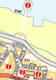
CENTRAL LONDON
Based on Ordnance Survey data, this tourist street map covers central London from Westminster to the City of London and the banks of the River Thames. |
|
|
THE LAKE DISTRICT (NORTH)
Based on Ordnance Survey data, this tourist map covers the northern Lake District, including Keswick, Derwent Water and Ullswater. |
|
|
THE LAKE DISTRICT (SOUTH)
Based on Ordnance Survey data, this tourist map covers the southern Lake District, including Windermere and Coniston Water. |
|
|
THE PEAK DISTRICT
Based on Ordnance Survey data, this tourist map is of the central area of the Peak District, including Buxton, Bakewell, Ashbourne and Matlock. |
|
|
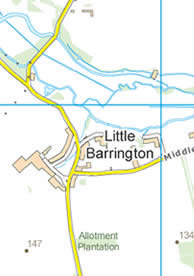
THE COTSWOLDS
Based on Ordnance Survey data, this tourist map covers the central Cotswolds, such as Stow-on-the-Wold, Moreton-in-Marsh and Bourton-on-the-Water. |
|
|
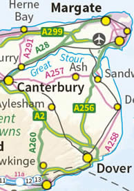
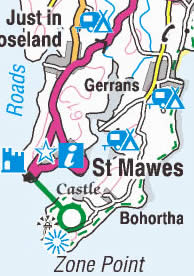
DEVON AND CORNWALL
Based on Ordnance Survey data, this route planning map is of the entire counties of Devon and Cornwall in south west England. |
|
|
ISLE OF PURBECK
Based on Ordnance Survey data, this tourist map covers the Isle of Purbeck in Dorset and the Jurassic Coast. |
|
|
EAST ANGLIA
Based on Ordnance Survey data, this route planning map is of the counties of Norfolk, Suffolk, Essex and Cambridgeshire in the East of England. |
|
|
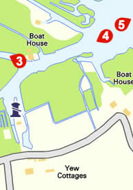
THE NORFOLK BROADS
Based on Ordnance Survey data, this detailed tourist map is of the northern rivers (Bure, Ant and Thurne). Includes public moorings, pubs, shops, tourist attractions and major footpaths. |
|
|
NORTH NORFOLK COAST
Based on Ordnance Survey data, this tourist map covers from Hunstanton in the west, to Overstrand in the east and the entire North Norfolk Coastline. |
|
|
EAST NORFOLK
Based on Ordnance Survey data, this tourist map covers the undiscovered eastern region of Norfolk, including the coast from Cromer around to Great Yarmouth, plus the northern Norfolk Broads. |
|
|
CROMER AND SHERINGHAM (Norfolk)
Based on Ordnance Survey data, this street map covers the area around the coastal towns of Cromer and Sheringham in North Norfolk. |
|
|
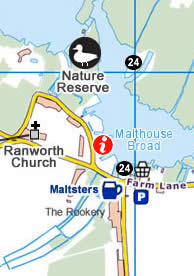
NORFOLK BROADS NAVIGATION MAP
Based on Ordnance Survey data, this navigation map is of the central Norfolk Broads waterways. Includes public moorings, waterway hazards and speed limits. |
|
|
MALVERN HILLS
Based on Ordnance Survey data, this tourist map is of the Malvern Hills, an Area of Outstanding Natural Beauty. |
|
|
THE FOREST OF DEAN
Based on Ordnance Survey data, this tourist map is of the Forest of Dean and the Wye Valley. |
|
|
THE ISLE OF WIGHT
Based on Ordnance Survey data, this tourist map is of the entire Isle of Wight. |
|
|
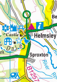
YORKSHIRE
Based on Ordnance Survey data, this route planning map is of the entire county of Yorkshire, including the Yorkshire Dales, North York Moors, the Yorkshire Coast and the City of York. |
|
|
SCOTLAND
Based on Ordnance Survey data, this route planning map covers the entire country of Scotland and all its surrounding islands. |
|
|
WALES
Based on Ordnance Survey data, this route planning map covers the entire country of Wales. |
|
|
We recommend that once you have loaded the map of your choice, you save the map to the homescreen of your smartphone or tablet - on an Apple device, tap the arrow/square icon - on an Android device tap the browser menu icon. If you do this, you will simply need to tap the homescreen icon to open the map in full screen mode. |
About MapZapp
Each FREE download includes the chosen map plus an app that includes great functions to allow you to not only pan & zoom the map offline, but also plenty of other great features:
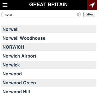
Search for place names and find on the map
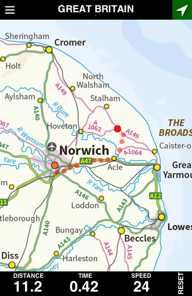
Track your location and see a location trail, plus a dashboard showing distance, time and speed.
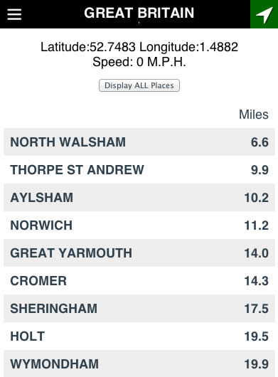
View a distance table from nearby places.
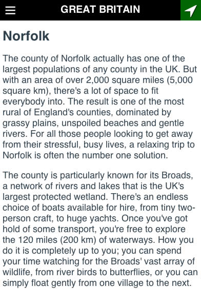
Access a built in text guide, informing you about local places.
Choose from maps at various scales.
MapZapp was developed to allow offline viewing of tourist maps. The maps have been wrapped within an app that runs inside a standard web browser. This provides a simple and easily maintainble way to distribute and support a large number of different map apps that can run on the majority of modern devices, without having to create different versions for different platforms and upload/manage them on different appstores.
Maps contain Ordnance Survey data, which is Crown copyright and database right 2017. We welcome your comments, suggestions and feedback, send email to
feedback@mapzapp.co.uk